A rare spring storm resembling a mini nor’easter swept through the New York and New Jersey region on Saturday, April 12, 2025, bringing an unexpected mix of snow, heavy rain, gusty winds, and cold temperatures—conditions more typical of late winter than mid-April.
A Cold, Wet, and Snowy Day
The storm system, classified as a coastal low, settled off the Jersey Shore and began affecting the Tri-State Area as early as Friday evening. By Saturday morning, many parts of the region woke up to steady rain and even snow in higher elevations and inland areas. Rainfall totals quickly climbed to over 2 inches in several locations, flooding streets and overwhelming drainage systems.
Parts of northern and western New Jersey saw the most dramatic impacts, with snowfall accumulations reaching up to 6 inches in some towns. This late-season snow event was especially surprising to residents who had already packed away their winter gear for the year.
Advisories and Flood Warnings Issued
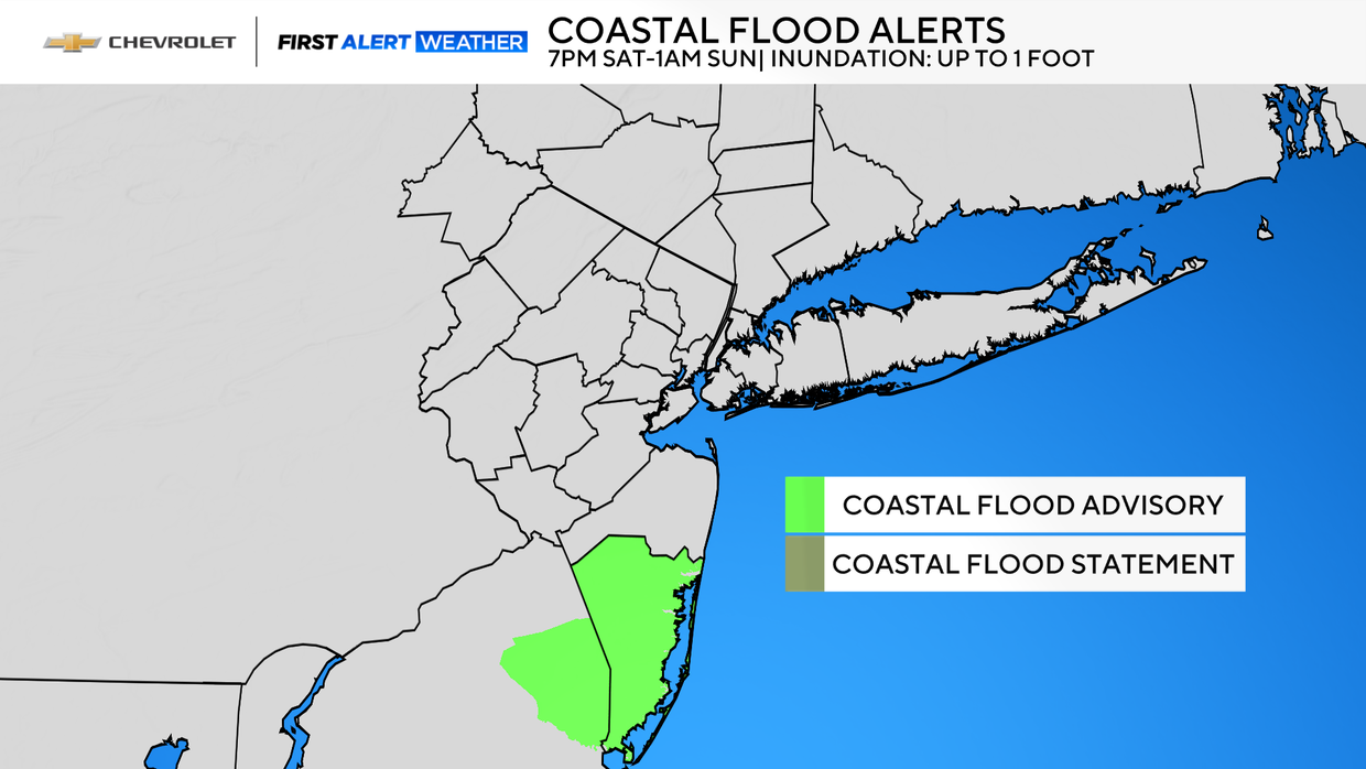
Due to the storm’s intensity, the National Weather Service issued several alerts across the region:
-
Winter Weather Advisories were posted for areas expecting accumulating snow and hazardous travel conditions.
-
Flood Watches and Coastal Flood Statements were issued for low-lying and shoreline areas. Tides combined with strong onshore winds pushed water levels up, leading to minor coastal flooding in parts of Long Island, Staten Island, and New Jersey’s Hudson, Essex, and Union counties.
-
A Coastal Flood Advisory was in effect for Ocean County, NJ, from 7 p.m. Saturday to 1 a.m. Sunday, warning of the potential for up to a foot of inundation in vulnerable areas.
Chilly Temperatures Break Spring Expectations
Despite the calendar saying April, temperatures across the New York City area on Saturday struggled to rise above the low 40s Fahrenheit (around 5°C). When combined with brisk winds, it felt more like a frigid day in February. The unseasonably cold air added to the wintry atmosphere, especially in areas where snow was falling or mixing with rain.
What Comes Next?
Meteorologists forecast that the worst of the storm would pass by early Sunday morning. A few lingering showers—especially across eastern Long Island—were expected through the night. But as the coastal low-pressure system moves farther out to sea, conditions should begin improving.
By Sunday afternoon, residents can expect clearing skies and warmer temperatures, with highs reaching the upper 50s to low 60s (around 14–17°C). This return to more typical spring weather will be a welcome change after a surprisingly frosty and stormy Saturday.